Quantarctica:一套專屬南極的GIS圖資
Quantarctica is a collection of Antarctic geographical datasets, such as base maps, satellite imagery, glaciology and geophysics data from data centres around the world, prepared for viewing in QGIS. The package is developed by the Norwegian Polar Institute, as a tool for the research community, for classrooms and for operational use in Antarctica –-- freely available for non-commercial purposes.
關於本專案
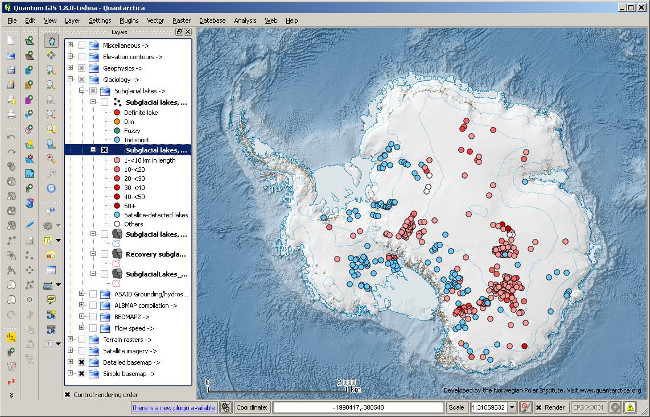
Quantarctica 的系統截圖,正展示冰底湖的其中一些資料集。
Quantarctica (QGIS Antarctica) 最初是為挪威極地研究所中冰川學家內部使用而開發的工具。需要一個低成本或免費且具有基本數據集 - 即用型、易於使用、功能豐富且具有離線功能的完整GIS。 QGIS似乎是收集資料集GIS的完美選擇。
Quantarctica has been used to examine geographical data from continental to local scales, for viewing scientific project data on top of base maps or with other scientific datasets, and to prepare maps for publications and proposals. Quantarctica has so far proven to be a great tool, and a very good alternative and supplement to other software used by the researchers. It has provided new opportunities for our researchers in their daily work.
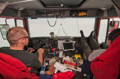
Quantarctica 同時為南極冰架導航帶來便利,這都要歸功於QGIS的GPS定位追蹤功能。
Since Quantarctica first came in use by our glaciologists three years ago, there has been many requests in the research community outside the institute to share this product, and we started to develop a public and improved version to replace the in-house version. Following Antarctic field testing, and adding new relevant datasets, Quantarctica version 1.0 was finally completed and made available for download in July 2013.
Quantarctica 完全有賴於社群的付出。這些貢獻旨在拓寬各類學科的分析數據,如海洋學、大氣科學,地質學和生物學等方面,我們期望並深信此工具作為一個完整的南極GIS圖資,能夠造福極地研究社群。
連結
Quantarctica 網站:https://www.npolar.no/quantarctica/
挪威極地研究所:https://www.npolar.no/en/
作者
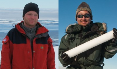
Anders Skoglund 與 松岡健一(Kenichi Matsuoka)
本文係由兩位在挪威基地研究所進行研究的GIS專家,Anders Skoglund(左)和松岡健一(右),於2013年8月提供。