អំពីQGIS
QGIS គឺជាប្រភពកូដបើកចំហនៃប្រព័ន្ធព័ត៌មានភូមិសាស្រ្ដ(GIS)ដែលងាយស្រួលប្រើ ក្រោមអាជ្ញាប័ណ្ណសាធារណៈទូទៅរបស់ GNU ។ QGIS គឺជាគម្រោងផ្លូវការនៃប្រភពកូដបើកចំហនៃលំហភូមិសាស្រ្ដរបស់មូលនិធិ (OSGeo) ។ វារត់នៅលើលីនុចនិងយូនីក, Mac OS OSX, Windows និង អ៊ែនដ្រយដ៍ និងគាំទ្រវ៉ិចទ័រជាច្រើន បន្ទាត់បញ្ឈរនិងទំរង់មូលដ្ឋានទិន្នន័យនិងមុខងារផ្សេងៗ។
Our latest release is QGIS 3.36
The Community
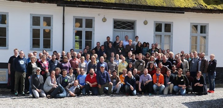
QGIS is a volunteer driven project. We welcome contributions in the form of code contributions, bug fixes, bug reports, contributed documentation, advocacy and supporting other users on our mailing lists and gis.stackexchange.com. If you are interested in actively supporting the project, you can find more information under the development menu and on the QGIS Wiki.

លក្ខណៈ
QGIS provides a continously growing number of capabilities provided by core functions and plugins. You can visualize, manage, edit, analyse data, and compose printable maps. Get a first impression with a more detailed feature list.
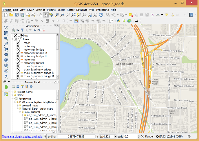
ធ្វើដំណើរទស្សនកិច្ចជាមួយលក្ខណៈរបស់QGIS

ករណីសិក្សា
We also collect case studies of how people all over the world use QGIS for their GIS work.
See our QGIS case studies
អង្គការគាំទ្រ
We welcome financial contributions in the form of sustaining memberships and donations.
អង្គការដែលគាំទ្រQGIS


គាំទ្រផ្នែកពាណិជ្ជកម្ម
តើអ្នកមានគម្រោងនឹងប្រើQGISនៅក្នុងក្រុមហ៊ុននិងអង្គការរបស់អ្នក ប៉ុន្តែមានការព្រួយបារម្ភថាតើមានជំនួយពាណិជ្ជកម្មឬទេ? នេះជាបញ្ជីអ្នកជំនួយម៉ៅការតាមលំដាប់តួព្យញ្ជនៈ ចែកជាផ្នែក។