QGIS 2.6 muutosloki
Release date: 2014-10-31
Muutosloki QGIS 2.6.0 versiolle. Olemme lisänneet monia uusia ominaisuuksia, parannuksia ja ja lisäpiirteitä tehdäksemme suosituimmasta avoimesta paikkatieto-ohjelmasta jopa entistä enemmän ominaisuuksia sisältävän ja käyttökelpoisemman.
Koska tahansa lisättäessä uusia ominaisuuksia tulee aina mahdolliseksi myös uudet virheet . jos huomaat mitä tahansa ongelmia tässä julkaisussa, ole ystävällinen ja kirjaa ilmoitus QGIS virheiden seurantajärjestelmään.
Haluamme kiittää kehittäjiä, dokumentoijia, testaajia ja kaikkia muita henkilöitä jotka vapaaehtoisesti käyttävät aikaansa ja resurssejaan (tai tukevat taloudellisesti muita tekemään siten).
From the QGIS community we hope you enjoy this release! If you wish to donate time, money or otherwise get involved in making QGIS more awesome, please wander along to qgis.org and lend a hand!
Lopuksi haluamme kiittää virallisia sponsoreitamme arvokkaasta taloudellisesta tuesta jota he ovat tarjoneet tälle hankkeelle:
GOLD Sponsor: Asia Air Survey, Japan http://www.asiaairsurvey.com/
HOPEA Sponsori: Sourcepole AG, Switzerland
HOPEA Sponsori: State of Vorarlberg, Austria
BRONZE Sponsor: Lutra Consulting, UK
PRONSSI Sponsori: www.molitec.it, Italy
PRONSSI Sponsori: www.argusoft.de, Germany
PRONSSI Sponsori: www.openrunner.com, France
PRONSSI Sponsori: GKG Kassel,(Dr.-Ing. Claas Leiner), Germany
A current list of donors who have made financial contributions large and small to the project can be seen on our donors list. If you would like to become an official project sponsor, please visit our sponsorship page for details. Sponsoring QGIS helps us to fund our six monthly developer meetings, maintain project infrastructure and fund bug fixing efforts.
If you enjoy using QGIS, please consider making a donation to support the project - either financial or of your time and skills! Lastly we would like to also take a moment to encourage you to fund a special campaign by one of our QGIS developers to get a working test suite for QGIS so that we can improve out quality assurance process and deliver you the best possible releases.
QGIS on vapaa ohjelmisto eikä sinulle ole mitään pakkoa maksaa sen käytöstä - tosiasiassa haluamme sinun rohkaisevan henkilöitä mahdollisimman laajalti käyttämään sitä huolimatta taloudllisesta tai sosiaalisesta tilasta - uskomme ihmisten tukemisen paikkatiedon päätöksentekovälineillä johtavan parempaan yhteiskuntaan koko ihmiskunnassa.
Yleistä
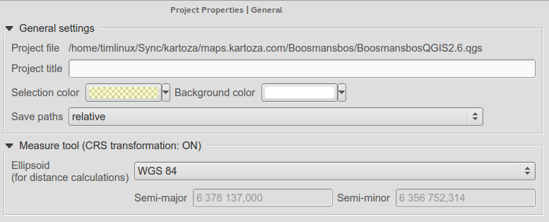
Ominaisuus: Projektin tiedostonimi asetuksissa
Voit nähdä QGIS projektin tiedostonimen koko polun projektin asetusten ikkunassa.
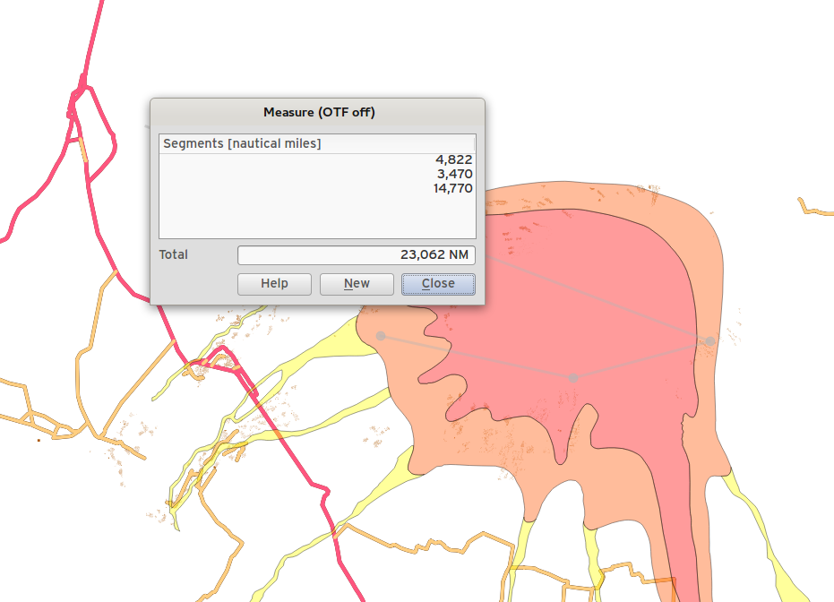
Ominaisuus: Sallitaan viimeisen pisteen poistaminen mittauksissa käyttäen del/backspace näppäintä
Nyt voit mitatessasi aloja ja etäisyyksiä poistaa ei-toivottuja kärkipisteitä mittaviivaltasi käyttäen delete tai backspace näppäintä.
Ominaisuus: Muokkaimen työkalut
Olemme tehneet joukon parannuksia muokkaimen työkaluihin:
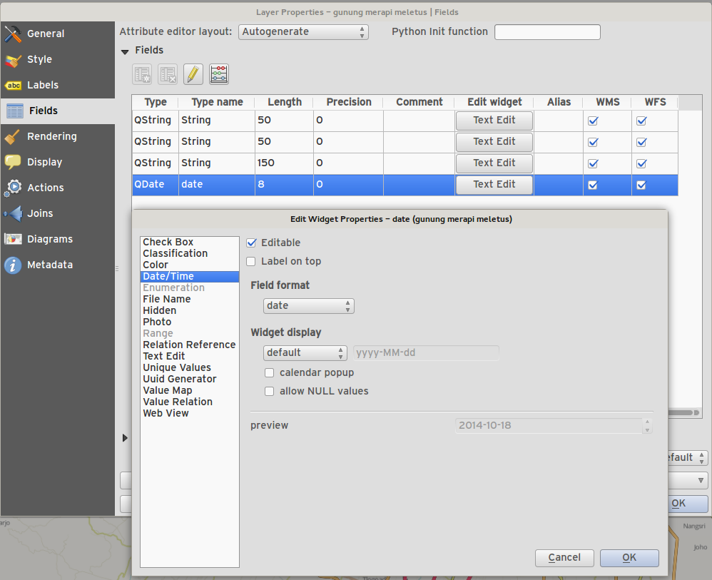
uusi muokkaimen työkalu päiväys/aika tiedolle jolla voi asettaa null päiväyksiä (tyhjiä)
suodatin viivan muokkaus
Muokkaintyökalussa kunnollinen NULL arvojen käsittely
Kuva työkalu säilyttää NULL arvon
Web työkalu säilyttää NULL arvon
Attribuuttitaulu osaa erottaa 0 ja NULL arvot
Lisää jälkikiite tukemaan arvorajojen työkalua
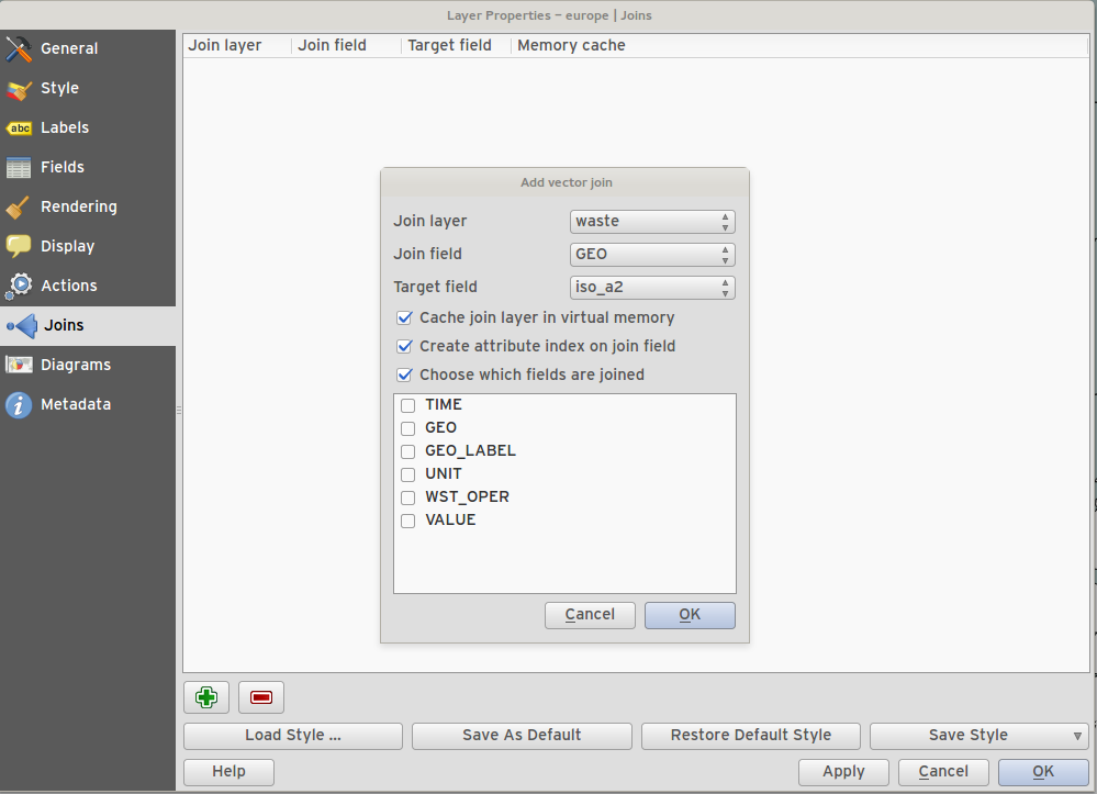
Ominaisuus: Käytä vaihtoehtoisesti vain osajoukkoa kentistä liitetystä tasosta
You can now use just a subset of related fields when creating a vector join.
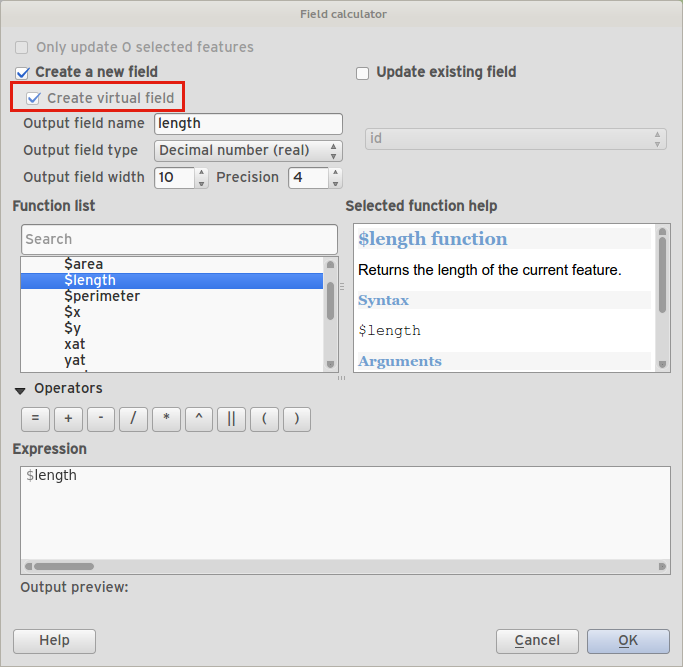
Ominaisuus: Lausekekenttä (virtuaalit kentät)
Toisinaan haluat että Sinulla olisi attribuutti joka on laskettu ja se olisi aina ’tuore’ - kuvastaen ominaisuuden asetusten nykytilaa. Nyt voit lisätä virtuaalisia tietoja tauluu jotka perustuvat lausekkeisiin.
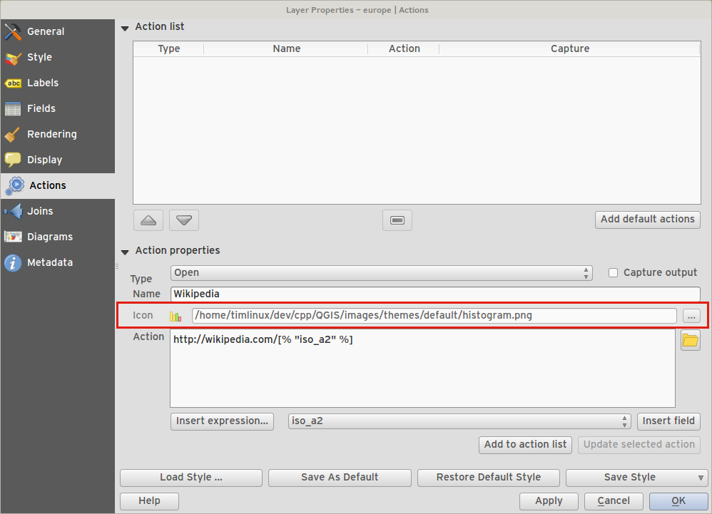
Ominaisuus: Toimintoihin voidaan nyt sitoa ikoni
Luotaessa vektoritasolle räätälöity toiminto, voit määritellä tälle toiminnolle myös ikonin.
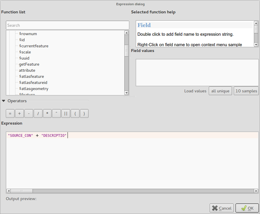
Ominaisuus: Lisää lauseketyyppejä ja vaihtoehtoja
Salli
+käyttö merkkijonojen yhdistämiseen.Uusi avainsana:
attribute( feature, attribute_name )- saa ominaisuudesta määritellyn attribuutin.Uusi avainsana:
$currentfeature- palauttaa nykyisen omianisuuden.Uusi avainsana:
$atlasfeature- palauttaa atlasominaisuuden.Uusi avainsana:
getFeature- saa tasosta vastaavan ominaisuuden.
Ominaisuus: Porrastettujen ja luokiteltujen hamotusten luokat ovat vaihdeltavissa
Voit nyt valita otaa pois käytöstä haluamasi porrastettujen ja luokiteltujen luokkien hahmottamisen kuitenkaan niitä poisttamatta.
Ominaisuus: Selitteen parannukset
Toinen vaihe selitteen / sisällysluettelon peruskorjauksesta on saatu päätökseen. Tämä sisältää:
API:n siistiminen (kehittäjille)
Karttatasojen näkyvyysryhmät tasorakenteessa. Tämä uusi työkalu mahdollistaa nopeat muutokset tasoryhmien välillä näkyvyydestä.
Mahdollisuus hallita tasoryhmiä selitteen työkalusta
Selitetyökalun uusi selitteen suodatusvaihtoehto poistaa selitteen jäsenet mistä tahansa luokasta jotka eivät ole näkyvissä aktiivisessä näkymässä. Tämä on mahtava parannus koska se varmistaa ettei kartan selitteessä ole jäseniä joita ei kartalla näy. Se on käytettävissä pääkartan selitteessä ja kartan muodostajassa ja WMS tasoilla.
Rule-based renderer legends can now be displayed in a pseudo-tree
Palvelun tarjoajat
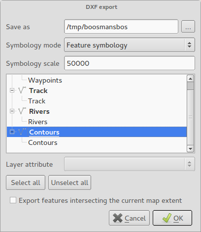
Ominaisuus: DXF viennin parannukset
rakennenäyttö ja tapahtuvan siirron vuoksi tason attribuuttien valinta ikkunassa
monikulmioiden/HATCH täytön tuki
tekstin esitysmuodoksi MTEXT TEXT:n sijaan (sisältäen kirjasimen, kaltevuus ja paino)
RGB värien tuki kun tarkkaa väriä ei täsmäävänä
käytä AutoCAD 2000 DXF (R15) asemasta R12
poista R18 testi metoodit
Kartan muodostaja
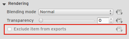
Ominaisuus: Ohjaus piilottaa kartan muodostajan jäseniä tulostuksessa/vienneissä
Olemme lisänneet valintalaatikon ja datamääritteisen näppäimen ohjaamaan josko jäsen suljetaan pois muodostajasta vienneissä/tulostuksista. Jos jäsen on merkkaamaton se on näkyvissä ainoastaan muodostajan suunnittelun aikana.
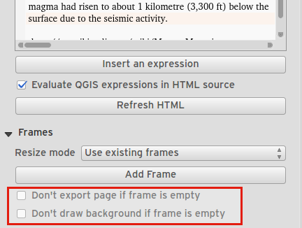
Ominaisuus: Sivun tulostuksen ohjaus tyhjille muodostajan raameille.
Tauluille ja HTML raameille, valintalaatikko ohjaa viedäänkö sivu kun raami on tyhjä.
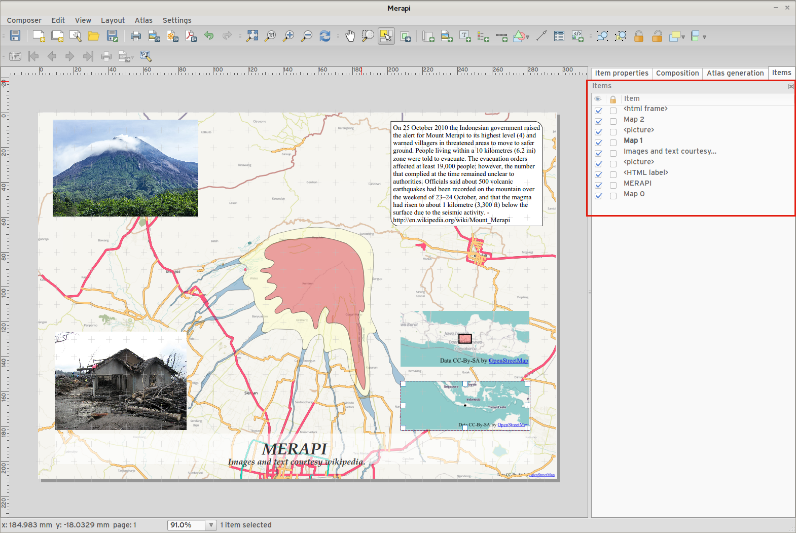
Ominaisuus: Jäsenten rakenteen paneeli
Jäsenten rakenteen paneeli kartan muodostajassa mahdollistaa jäsenten valinnan, jäsenten piilottamisen/näyttämisen, jäsenten lukitustilan vaihtamisen ja kaksoisklikkaamalla jäsenen id muokkaamisen. Voit myös vetää ja pudottaa jäsenten uudelleen järjestämiseksi.
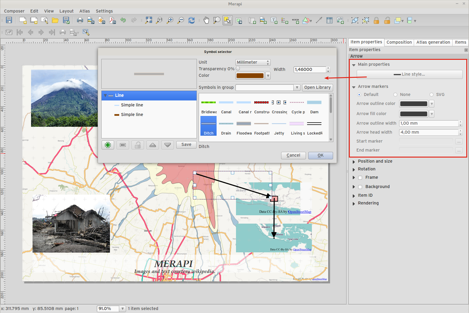
Ominaisuus: Lisää ohjausmahdollisuuksia muodostajan nuoli/viivajäsenten esittämiseksi
Viivat voidaan tyylittää käyttäen viivasymbolien tyylivalintaa
Nuolenpään täytön ja ääriviivojen värit ovat käyttäjän määriteltävissä
Nuolenpään ääriviivan leveys on käyttäjän määriteltävissä
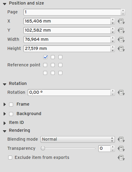
Ominaisuus: Muodostajan jäsenten data määritteinen ohjaus
Many properties of composer items can now be controlled using data binding. These include:
Transparency and blend mode.
Item rotation.
Map scale, extents and rotation.
Atlas feature margin.
Item size and position.
Page size, orientation and number of pages.
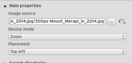
Feature: Composer images can be specifed as remote URLS
Picture items in the map composer now support remote urls as a picture source. This source can also be data defined.
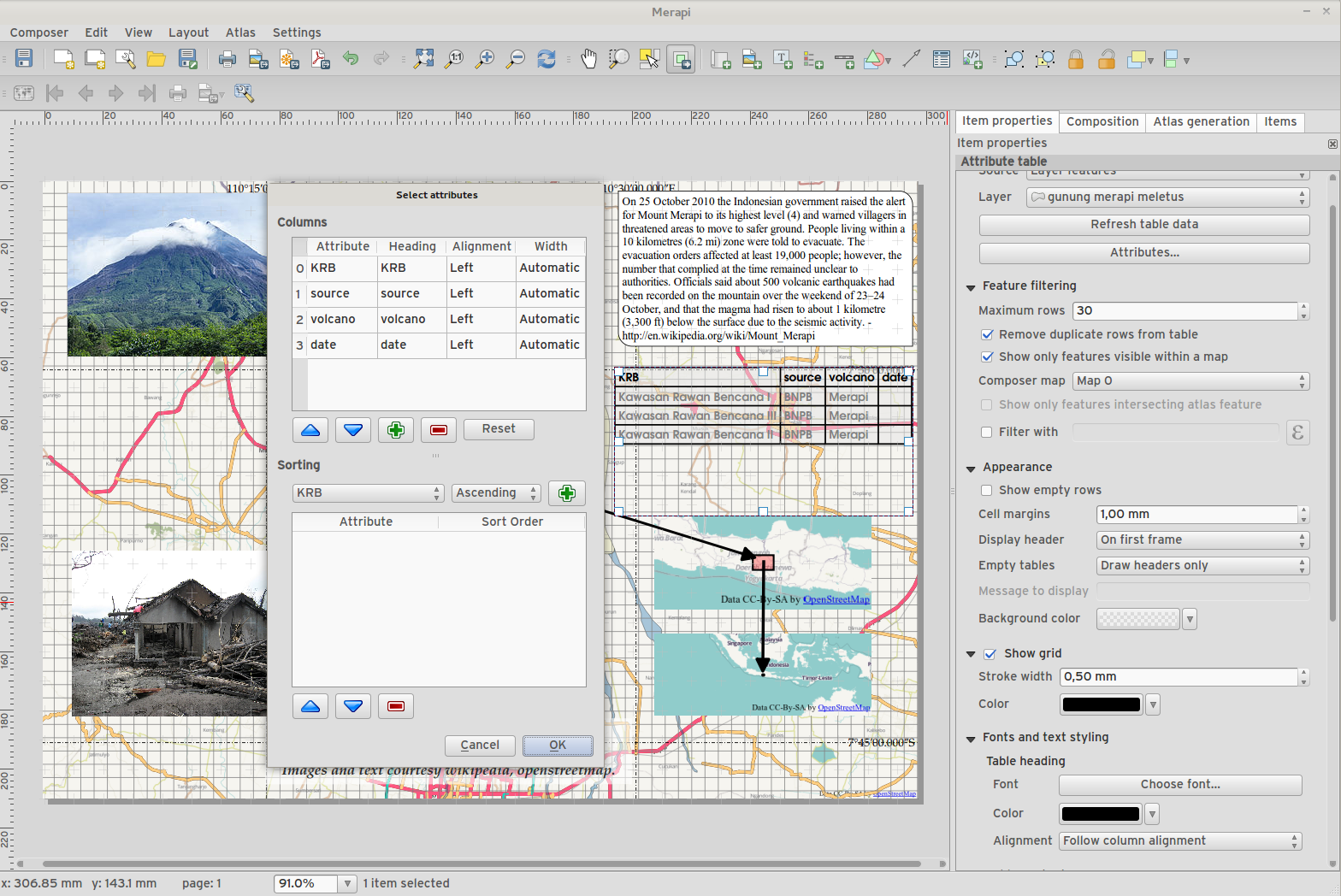
Feature: Composer Table improvements
You can now set table header and content font colors.
Tables can now be split across multiple frames, allowing their content to be distributed over columns or over different pages.
Added option show headers on first frame, all frames, or no frames.
Allow manual control of column widths.
New options for table source, including current atlas feature and child features from a relation.
Choice of behaviour for empty tables, include hiding the entire table, showing empty cells, or displaying a set message in the table body.
Added a checkbox to filter table features to those which intersect the current atlas feature.
Added checkbox to remove duplicate rows from table.
Note that tables in existing projects are not automatically updated to the new table format which supports these features, and tables must be readded to a composition for the new settings to appear.
Feature: Composer improvements
The map composer (used to prepare printable map compositions) has received a number of improvements in QGIS 2.6.
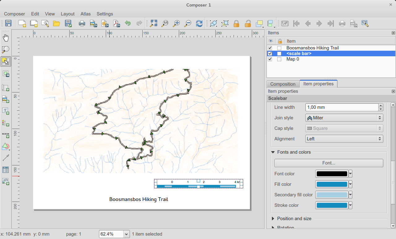
You can now change the secondary fill color for scalebars
Holding shift while drawing line/arrow items constrains drawing to horizontal, vertical or 45 degree angles
Holding shift while drawing other new items constrains them to squares, holding alt causes item to be drawn from the center
Right click no longer locks/unlocks items, this is now handled by the new items panel. Locked items can no longer be selected from the composer canvas, allowing for interaction with items below them.
Holding alt while pressing cursor keys results in a 1px movement for items
Removed the destructive ’Load from template’ menu item, replace with a new non-destructive ’Add items from template’ action
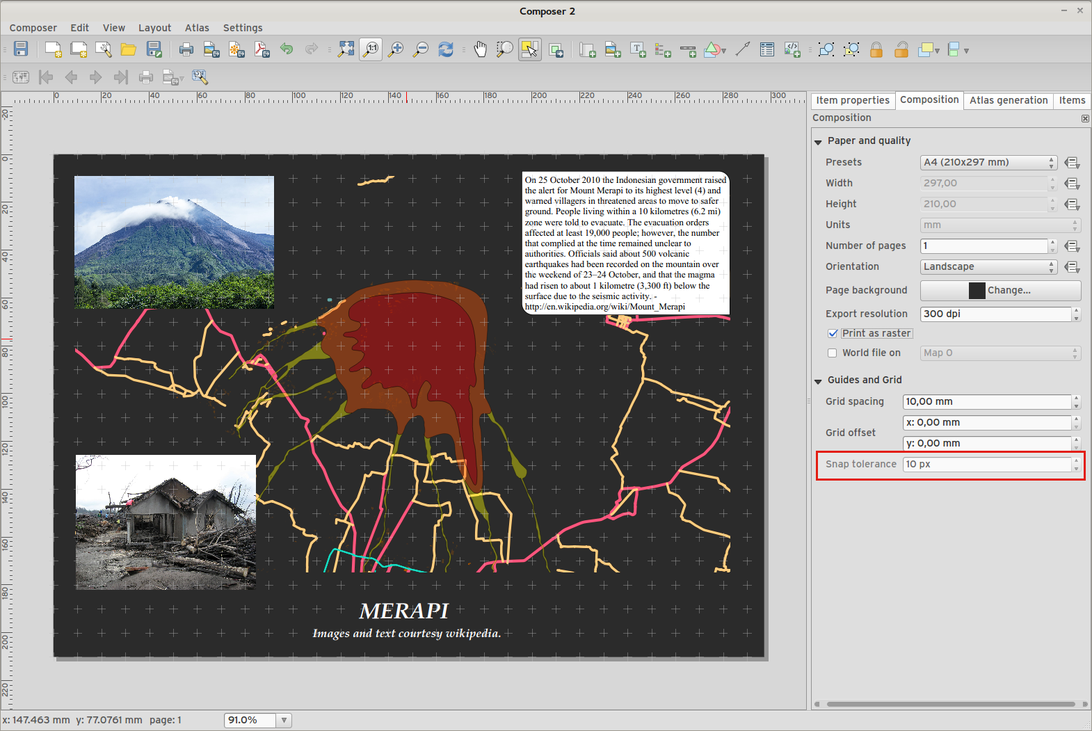
Feature: Improved item snapping
Snapping thresholds are now set in pixels, allowing for finer movement and resizing of items when zoomed in to a composition. Items within a group are no longer used for auto snap lines.
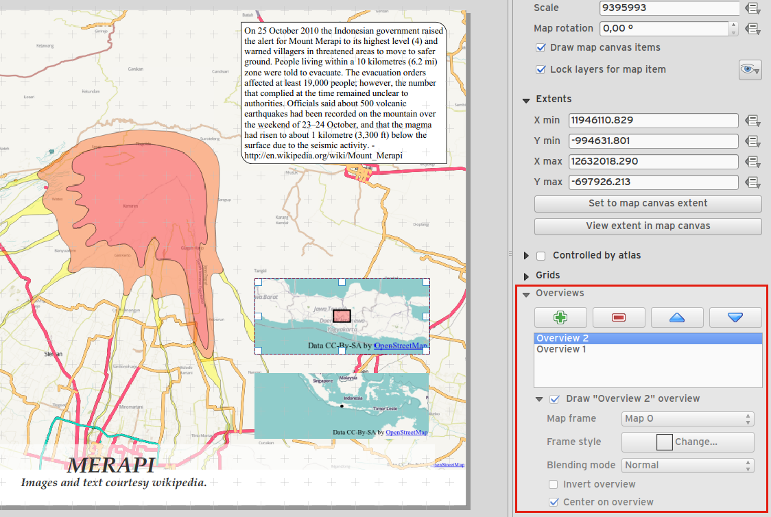
Feature: Multiple overviews for a map item
Sometimes it is useful to be able to show more than one overview frame for a map frame. For example if you want to show where your map is in local, regional and global context, using multiple overview maps can help you to achieve this. As of QGIS 2.6 you can now achieve this by assigning as many maps as you like to the ’overview’ role in your composition.
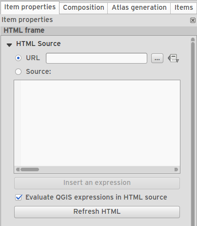
Feature: HTML item improvements
There are a number of useful new options for the HTML composer item:
Option for manual entry of HTML source
QGIS expressions within HTML source can be evaluated prior to rendering HTML content
Data defined URL for HTML source
Allow for creating a user stylesheet to override HTML styles
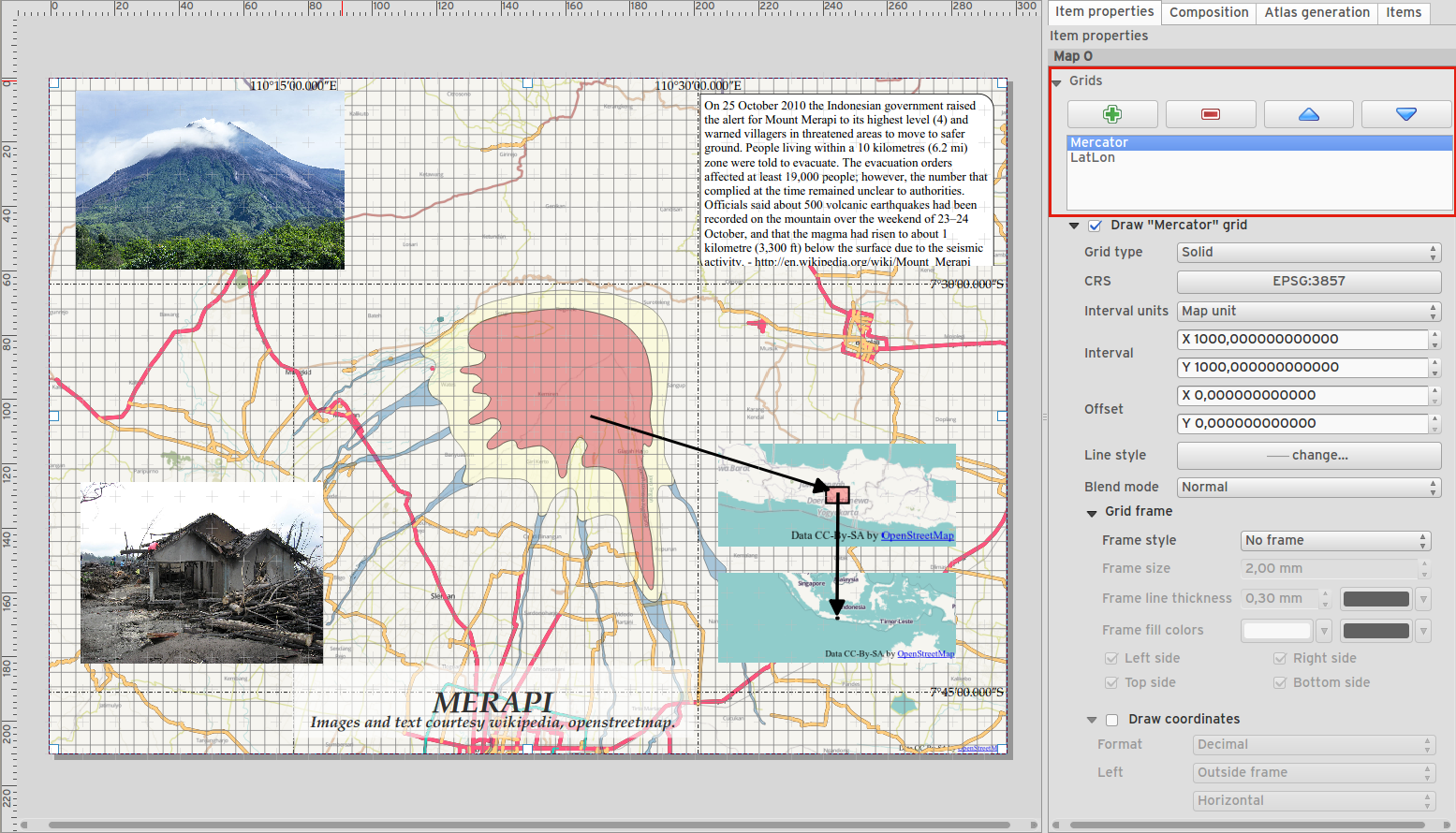
Feature: Composer map grid improvements
You can now have multiple grids with different properties.
You can mix reprojected grids and Lat/Long grids.
You can use standard QGIS symbology grid lines etc.
There is a new frame/annotations only grid style. Selecting this style causes only the frame and annotations to be drawn, with no grid lines or other markings over the map.
There are now options for controlling which side of a map item the frame is drawn on.
There are new tick styles for frames, with inner ticks, outer ticks and both inner and outer tick options.
We have made improvements to grid annotations, including many new formats for annotations.
Grid annotations now use the typographically correct prime and double prime symbols for grid annotations.
Prosessointi
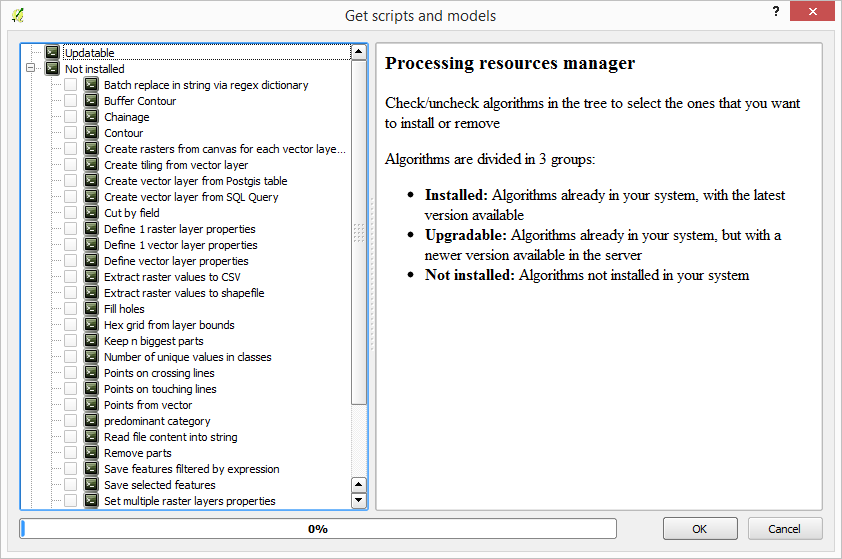
Feature: On-line collection of models and scripts
Models and scripts can be downloaded from the online collection and installed directly from the Processing interface. The collection will be expanded with new scripts and models provided by Processing users.
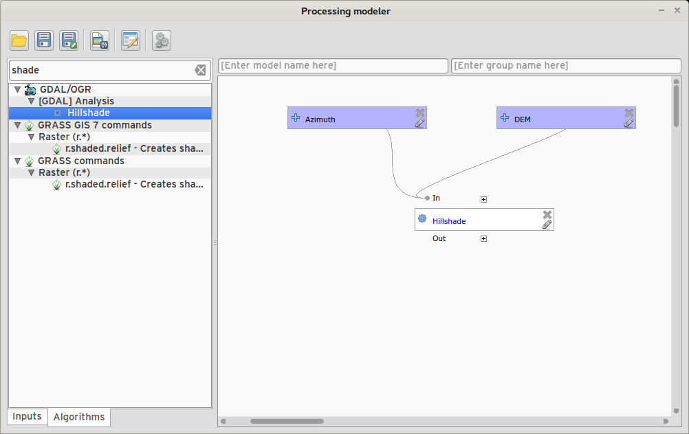
Feature: New modeler implementation
The modeler has been rewritten, and now provides extra functionality such as allowing nested models with no depth limit. Models are now stored as JSON files. Backwards compatibility is kept, so all models can still be used. You can also now drag and drop items from the inputs and algorithms onto the modeler graph.
Ohjelmoitavuus
Feature: API changes for QGIS widgets
In order to normalise the naming of QGIS widgets, some minor API changes have been made. Almost all edit widgets were renamed by adding ”Wrapper” at the end of their names. In particular this concerns:
QgsCheckboxWidget -> QgsCheckboxWidgetWrapper
QgsClassificationWidget -> QgsClassificationWidgetWrapper
QgsColorWidget -> QgsColorWidgetWrapper
QgsEnumerationWidget -> QgsEnumerationWidgetWrapper
QgsFilenameWidget -> QgsFilenameWidgetWrapper
QgsHiddenWidget -> QgsHiddenWidgetWrapper
QgsPhotoWidget -> QgsPhotoWidgetWrapper
QgsRangeWidget -> QgsRangeWidgetWrapper
QgsTexteditWidget -> QgsTexteditWrapper
QgsUniquevalueWidget -> QgsUniquevalueWidgetWrapper
QgsUuidWidget -> QgsUuidWidgetWrapper
QgsValuemapWidget -> QgsValuemapWidgetWrapper
QgsValuerelationWidget -> QgsValuerelationWidgetWrapper
QgsWebviewWidget -> QgsWebviewWidgetWrapper
QGIS-palvelin
Feature: Enhancements of searching with GetFeatureInfo request
https://github.com/qgis/QGIS/commit/8888c5f0c0e0ffdf23453a20addf6abaf125845d
Feature: Add a precision setting for GetFeatureInfo geometry attributes
Kuvaustekniikka
Feature: Better random colour choice
We have improved the random colour algorithm for classified renderer so that the colours generated are more visually distinct from each other.
Feature: Symbology user interface improvements
Where possible, properties of symbol layer are maintained when changing symbol layer type.
Added an edit button for shapeburst and gradient color ramps.
Automatic update of label and neighboring ranges boundaries.
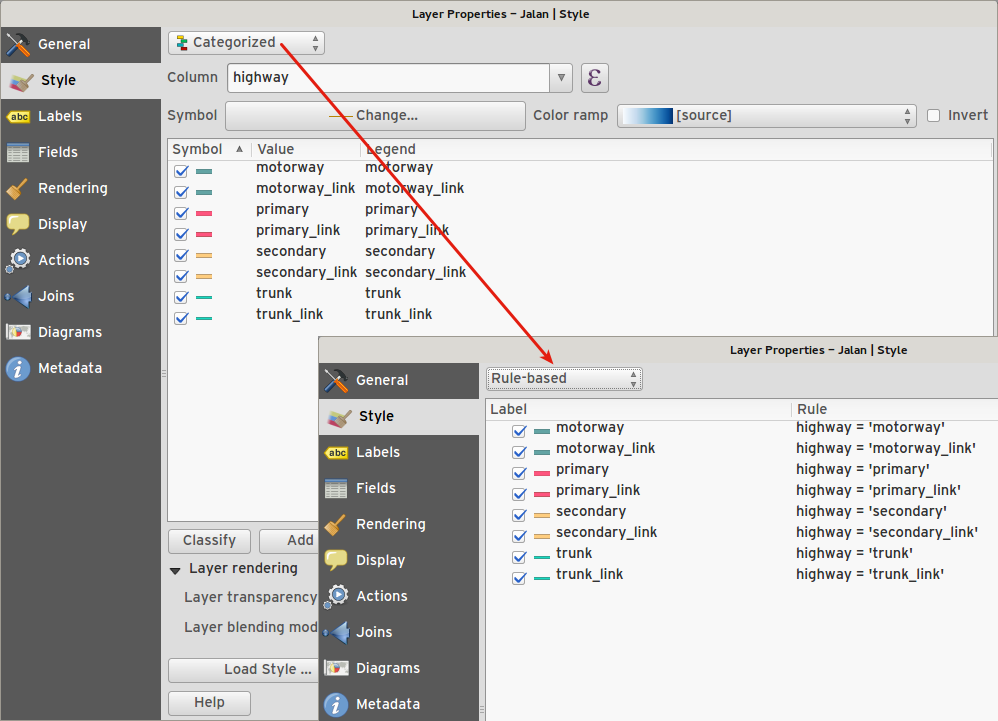
Classes are automatically converted from categorised and graduated classes when switching to rule based renderer.
Added units and number of decimal places to graduated renderer labels.
Improved responsiveness to changes in color ramp, inverted colour ramp, and other options in GUI.
Retain symbol when switching between simple, graduated, categorized, and other renderers.
Improved labelling of StdDev calculation mode.
Käyttöliittymä
Feature: Syntax highlighting code editor
For python script editors, expression builder, filter window, composer HTML and CSS editors
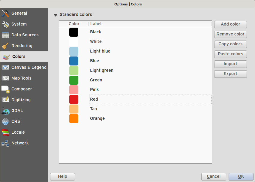
Feature: Color palettes
You can now define your own custom color palettes for use in QGIS.
Custom user global color palette (in options dialog).
Per project color palette (in project properties dialog).
Colors are shown in color button menus and new color picker dialog.
You can import/export colors to a GPL palette file.
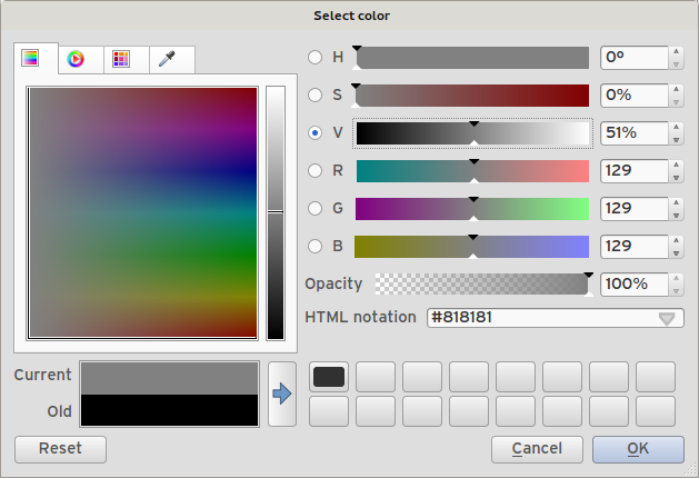
Feature: New color picker dialog
- There is a new custom QGIS color picker dialog. Features include:
Sliders for hue, saturation, value, red, green, blue color components.
Alpha slider.
Option to copy/paste html color codes (in a variety of formats).
Before/after color preview, with alpha preview.
Interactive 2D color ramp widget.
Hue wheel/triangle widget.
Editable color palettes, including the ability to create new palettes and import/export colors to a GPL palette file.
Live color sampler with option to sample over a set radius (OS support dependant).
Supports interaction with other apps via drag and drop of colors (OS support dependant).
Option to disable the dialog and use the native picker dialog instead.
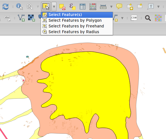
Feature: Single select feature tool merged into select by rectangle
We have merged the single selection tool into the rectangle tool. If you want to select a single feature, simply enable the rectangle tool and then single click (rather than dragging a rectangle) a feature.
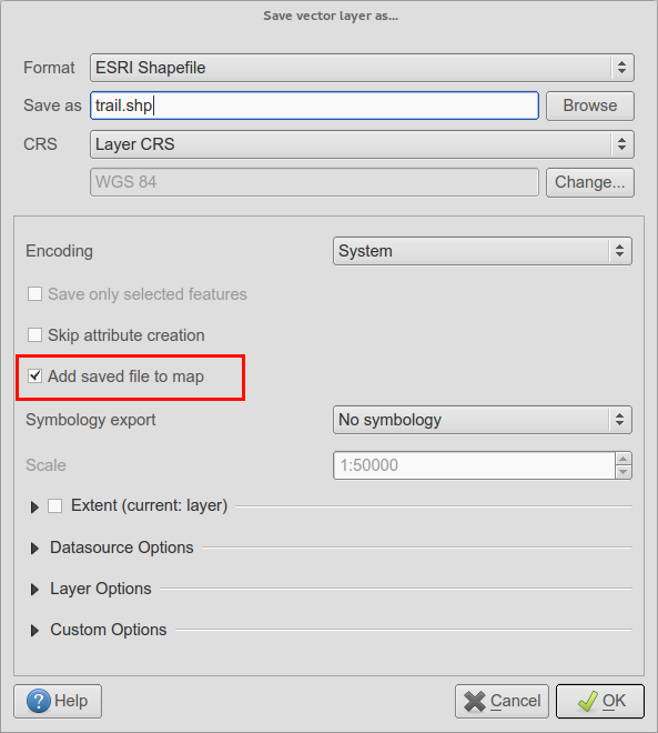
Feature: Add layer to map canvas behaviour
In many of QGIS’ dialogs that generate a new layer, the ’Add layer to map canvas’ checkbox is now checked by default so that the new layer automatically gets added to the map.
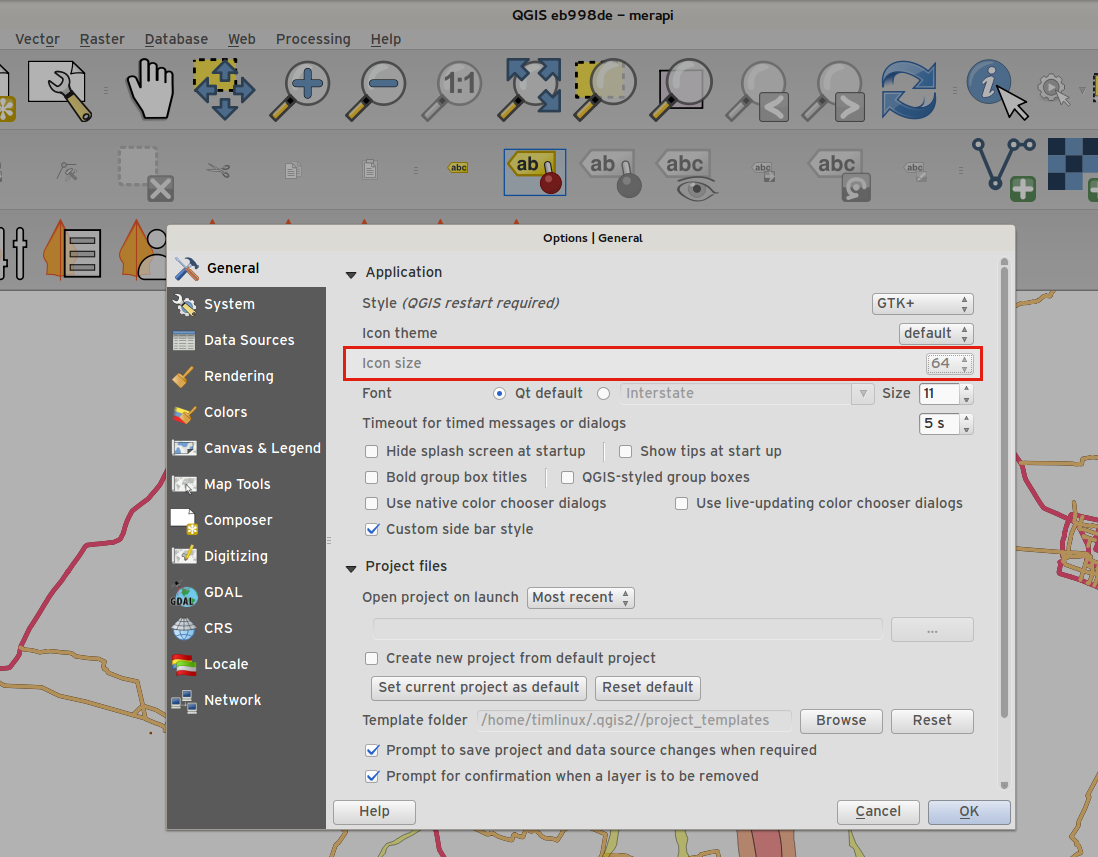
Feature: Add icon size 48 and 64
For those using QGIS on touch devices (or if you just like big, chunky icons), you can now set the icons up to 64 x 64 pixels in size.
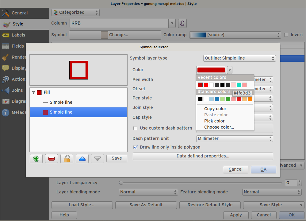
Feature: New colour buttons
This is probably one of the most useful new features in QGIS 2.6 - especially if you are involved a lot in cartography work. The colour button used everywhere in QGIS has been enhanced, with drop down menus, colour swatches, default colours, etc. Click on the drop down item to the right of the colour button to see the quick options. Click on the button to the left of the colour widget to see a standard colour chooser dialog.
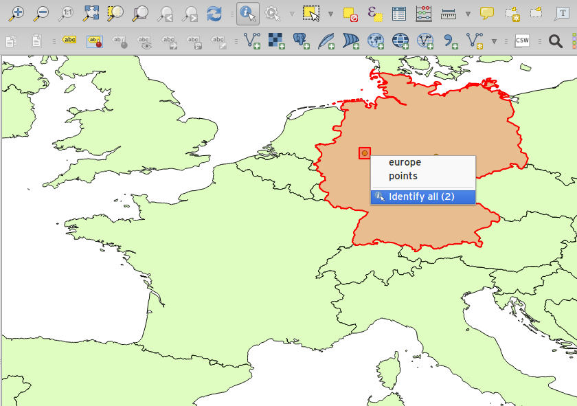
Feature: Context menu for identify tool
When using the identify tool, you can now right click on the canvas to use the identify tool in context mode. In the menu that appears you can define which feature types you wish to identify (all all if you like).